
Floodplains
No-Rise Analysis and Floodplain Development in Oregon and Washington
HEC-RAS modeling, No-Rise certifications, and compensatory storage design for projects in a FEMA floodway or floodplain, plus the coordination with the floodplain administrator that gets the permit issued.
If a project is in a FEMA regulatory floodway, the local floodplain administrator cannot issue a permit until an engineer certifies that the work will not raise the base flood elevation. That certification depends on a hydraulic model, and the model has to start from the effective FEMA study, be modified correctly, and be documented so the reviewer can follow it.
No-Rise requirements apply to buildings, bridges, culverts, fill, and even fences and stream restoration in the floodway. Projects elsewhere in the floodplain face a different set of requirements: elevation, flood-resistant construction, and, in many Oregon and Washington jurisdictions, balanced cut and fill or compensatory storage.
Cascadia Civil prepared the No-Rise analysis that let a new commercial building proceed in the Necanicum River floodway in Seaside. Our principal engineer also completed a No-Rise analysis for a bridge rehabilitation over the South Yamhill River while at a previous firm, and has modeled floodplains on fish passage and bridge projects across Oregon and Washington.
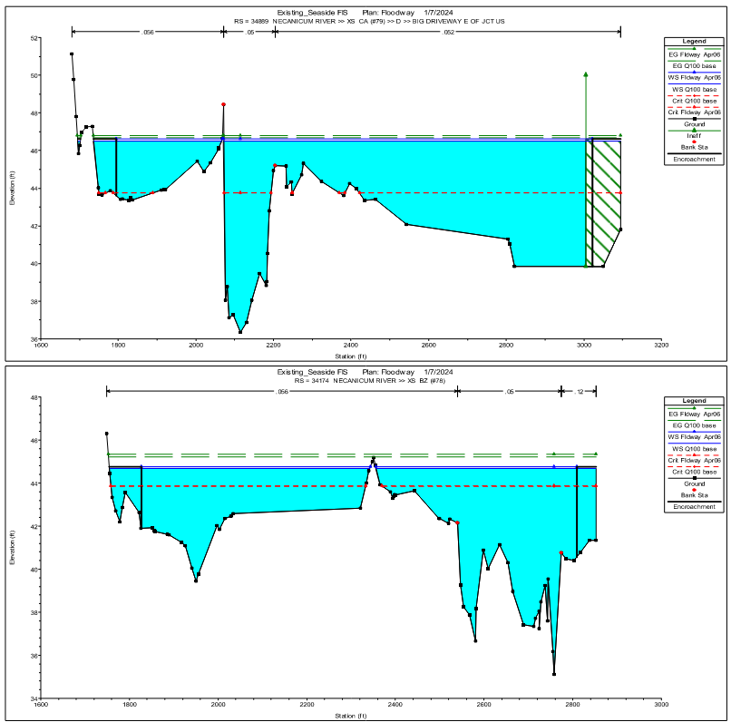
What a No-Rise certification is
An engineer's certification, backed by a hydraulic model.
Federal floodplain regulations (44 CFR 60.3(d)(3)) prohibit encroachments in a regulatory floodway unless a hydrologic and hydraulic analysis shows the encroachment would not increase flood levels during the base flood, the flood with a one-percent chance of occurring in any year. A No-Rise certification is the engineer's signed statement, supported by that analysis, that the project meets this standard.
In practice, the analysis compares the effective FEMA model with a revised model that includes the proposed project. The results must show no increase in water surface elevation at any cross section, which means 0.00 feet when reported to two decimal places. If a project cannot meet that standard, the usual path is a Conditional Letter of Map Revision (CLOMR) from FEMA, a much longer and more expensive process. That is why it pays to test the design early.
HEC-RAS modeling
Built on the effective model, documented for the reviewer.
Most No-Rise analyses use HEC-RAS, the U.S. Army Corps of Engineers hydraulic model FEMA uses for most flood studies. The standard approach builds a sequence of models, so every change in water surface elevation can be traced to its cause:
- Duplicate effective model: the FEMA model rerun to confirm it reproduces the published flood elevations
- Corrected effective or existing conditions model: updated with current survey or corrected errors, where needed
- Proposed conditions model: the project added, with the same flows and boundary conditions
- Comparison tables at every cross section, with plots and a written report
Where no effective model exists, a model is built from survey and the Flood Insurance Study, and the approach is agreed with the floodplain administrator before the analysis is finalized. For bridges and piers, we add scour analysis to HEC-18.
Compensatory storage
Balancing cut and fill in the floodplain.
Many Oregon and Washington jurisdictions require that fill placed in the floodplain be offset by an equal or greater volume of excavation, at corresponding elevations and hydraulically connected to the floodplain. We design the grading to achieve that balance and document it with cut and fill volumes by elevation band.
Requirements are changing. In Oregon, FEMA's measures implementing the 2016 NMFS biological opinion on the National Flood Insurance Program add expectations for no net loss of floodplain storage, water quality, and riparian vegetation in many communities. We confirm the current local requirements at the start of every project.
Floodplain administrator coordination
The reviewer is part of the design process.
Every community in the National Flood Insurance Program has a floodplain administrator, usually in the planning or building department, who issues floodplain development permits. We contact them early to confirm which model to use, the report format they expect, and any local requirements beyond FEMA's minimums. We then answer their review comments through to permit issuance.
What’s included
From floodway screening to a signed certification.
Analysis
- Floodplain and floodway screening for a site
- Effective FEMA model acquisition and review
- HEC-RAS 1D and 2D hydraulic modeling
- Duplicate effective, existing, and proposed condition models
- No-Rise certification and hydraulic report
- Scour analysis for bridges and piers (HEC-18)
Design & permitting
- Compensatory storage and balanced cut-and-fill grading
- Floodplain development permit support
- Coordination on elevation and flood-resistant construction
- CLOMR and LOMR scoping where No-Rise cannot be met
- Coordination with floodplain administrators and state and federal agencies
How it works
From first question to finished project.
Screen the site
We confirm whether the project is in the floodway, the floodplain, or both, and which local and federal requirements apply.
Get the effective model
We request the effective hydraulic model from FEMA or the community and confirm it reproduces the published flood elevations.
Model existing and proposed conditions
The project is added to the model, including buildings, fill, piers, and grading, and the results are compared at every cross section.
Refine the design
If the results show a rise, we work with the designer to adjust the footprint, fill, or opening and test again.
Certify and permit
We prepare the hydraulic report and No-Rise certification, and answer the floodplain administrator's review comments.
Related services
Related projects
No-Rise Analysis work in Oregon and Washington.
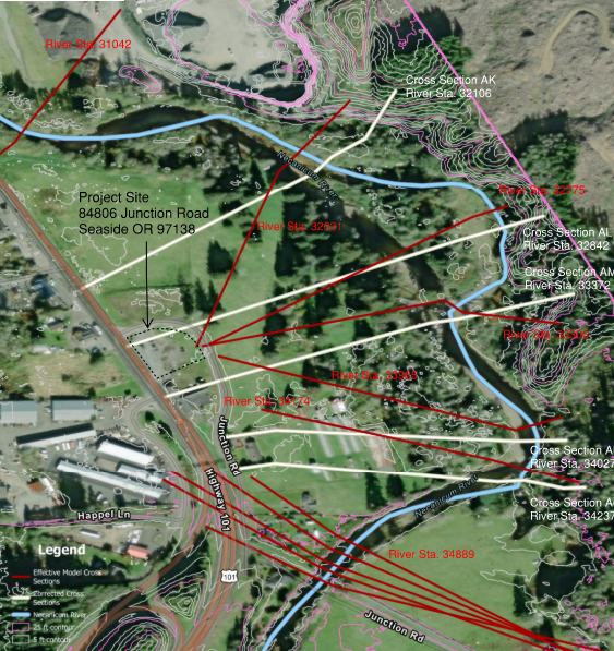
Water Resources / Permitting
Necanicum River Floodway No-Rise Certification for a New Seaside Commercial Building
Seaside, Oregon
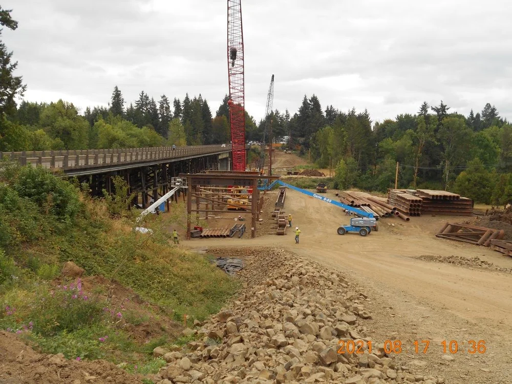
Water Resources / Permitting
DeJong Road Bridge Rehabilitation No-Rise Analysis on the South Yamhill River
Sheridan, Oregon
Completed by our principal engineer while at a previous firm.
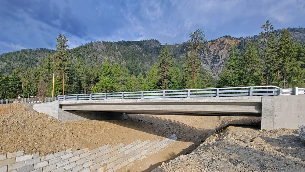
Water Resources
Stemilt Creek Bridge Scour Repair and Steelhead Channel Restoration
Chelan County, Washington
Our principal engineer served as engineer of record at a prior firm.
Questions
Frequently asked questions.
What is a No-Rise certification?
It is an engineer's signed certification, supported by a hydraulic analysis, that a project in a FEMA regulatory floodway will not increase the base flood elevation. Local floodplain administrators require it before they can issue a permit for floodway development.
Do I need a No-Rise analysis if my project is in the floodplain but not the floodway?
Usually not a No-Rise certification, which is a floodway requirement. Floodplain development still needs a local floodplain permit and may require elevation certificates, flood-resistant construction, and compensatory storage. Some communities apply stricter standards, so we confirm with the floodplain administrator.
What if there is no FEMA model for my stream?
Some floodways were mapped with approximate methods or with older models that are no longer available. In that case a model is built from survey, the Flood Insurance Study, and the effective maps, and its approach is agreed with the floodplain administrator before the analysis is finalized.
What happens if the analysis shows a rise?
The design can often be adjusted by shifting or reshaping a structure, removing fill, or enlarging an opening, and then retested. If no reasonable design meets the standard, the project would need a CLOMR from FEMA before construction and a LOMR afterward.
What drives the cost of a No-Rise analysis?
Whether a usable effective model exists, the length and complexity of the modeled reach, the type of encroachment (a building footprint is simpler than a bridge), whether survey is needed, and how many design iterations it takes. Compensatory storage design and scour analysis add scope.
Start a project
Building in a floodway or floodplain?
Send the site address and a description of the project. We will check the FEMA mapping and tell you what the analysis involves.